



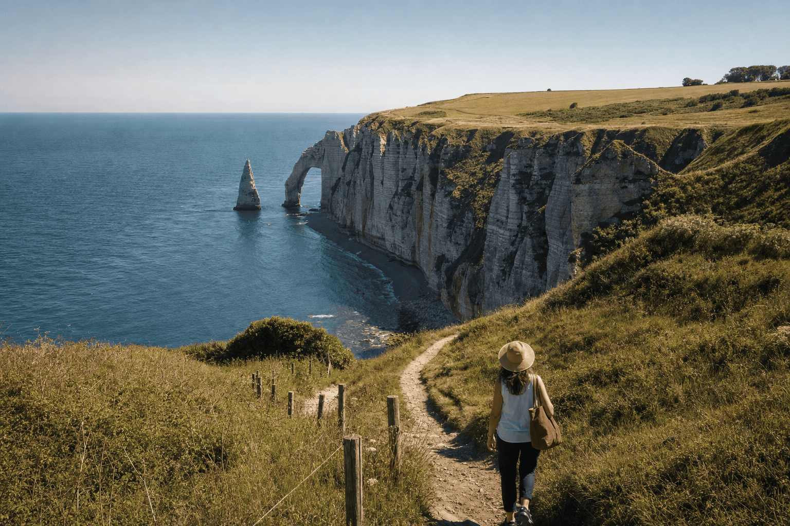
Étretat–Antifer Hike: Cliffs and Valleuse
Étretat
This Étretat–Antifer hike lets you discover the Côte d’Albâtre beyond the beach and the most popular viewpoints. Between the chalk cliffs, the Pays de Caux plateau and the Antifer valleuse, the landscape alternates between views of the English Channel, meadows, hedgerows and more sheltered paths. This is not a single, continuous trail guaranteed to be open year-round: the route combines several sections whose opening status, signage and access conditions should be checked before departure. For the full route, allow approximately 12 to 15 kilometers each way, depending on the variations, with an estimated elevation gain of 250 to 350 meters. Plan on about 4 hours 30 minutes to 6 hours of walking, not including breaks, and arrange your return before setting out.
Practical information
Download an offline map, wear shoes with good traction, and bring water, a windbreaker, snacks and a portable charger. For a one-way route, confirm your return arrangements before setting out and do not rely on an improvised solution at the end of the day.
Getting to Étretat from Paris for your hike
Booking Paris Transfer can arrange private transportation from Paris, your hotel, CDG or ORY to Étretat, with a return to Paris according to your schedule. The service covers transportation only; it does not include tickets, local guiding or any guarantee of access to a trail that is closed or has been changed. For a one-way hike, confirm the drop-off point and return arrangements in advance.
Departure from Paris, a Paris hotel, CDG or ORY; return to Paris to be planned according to the duration and conditions of your hike.
Understanding the Route Between Étretat and Antifer
The route between Étretat and the Antifer valleuse offers a gradual introduction to the Côte d’Albâtre. From the heights of Étretat, views extend over Porte d’Aval, the Needle and, depending on the route’s direction, Manneporte. As you leave the busy center behind, the landscape becomes more rural: meadows, farm tracks, hedgerows and enclosed farmsteads make up the Pays de Caux plateau.
However, this hike should be planned as a succession of accessible sections, not as a single trail guaranteed to be open year-round. The route may vary depending on closures, construction, ground conditions or local instructions. The advertised 12 to 15 kilometers is an estimated one-way distance, while a loop can exceed 20 kilometers. Walking time depends greatly on breaks, wind, mud and necessary detours.
Before setting out, compare your route with the information from the Étretat town hall and local tourism resources. This check is more reliable than an old track found on a community-based app.
Chalk Cliffs and Valleuse Landscapes
The Étretat cliffs belong to the larger chalk landscape of the Pays de Caux. Their distinctive shape results from slow erosion caused by the sea, runoff and water seeping into the chalk. The arches and needles are therefore natural formations that continue to evolve. Even in calm weather, an edge may be unstable and rocks may fall from beneath a cliff face.
A valleuse is a depression cut into the Pays de Caux plateau that leads toward the coast. The Antifer valleuse combines woodland, meadows and limestone habitats, creating an atmosphere different from the wind-exposed cliffs. The descent brings cooler conditions, but it also adds difficulty to the route. If you return to the plateau, be sure to factor the climb back up into your effort estimate.
The site also has recognized ecological and landscape value. The Conservatoire du littoral presents the Antifer valleuse and its conservation concerns. Observe the terrain without leaving authorized paths.
Plan the Route and Assess the Effort
To structure your day, start in the Étretat cliff area and follow only the open sections of the coastal path or marked local routes. The first few kilometers offer the most famous views and are often the busiest. From there, progress toward the areas around Le Tilleul and La Poterie-Cap-d’Antifer takes you through a more rural environment. Do not cross cultivated land or follow a track that passes through a fence.
A practical estimate can divide the route into three sections: approximately 4 to 6 kilometers around the cliffs and Étretat plateau, 5 to 7 kilometers toward the Antifer area, then roughly 2 kilometers to the chosen point in the valleuse. These figures are not an official route and may change depending on access. The estimated elevation gain of 250 to 350 meters mainly comes from descending into and climbing out of the valleuse.
An old GPX track should not be followed blindly. Use it only as a supplementary reference and prioritize recent information from local authorities or tourism offices.
Wildlife, Plants and Responsible Observation
The contrast between the exposed plateau and the valleuse creates several natural environments. The hedgerows and meadows of the Pays de Caux are home to many insects and birds, while the valleuse woodlands provide a cooler, more sheltered habitat. The limestone grasslands may support plants adapted to poor, well-drained soils. Visible species and flowering periods change throughout the seasons.
From the cliffs, seabirds may be seen above the English Channel. Keep a sufficient distance from nests and avoid noisy stops near sensitive areas. Wildlife photography never justifies crossing a fence or approaching an unstable edge. If you are hiking with a dog, keep it under control whenever required by livestock, regulations or the terrain.
Stay on authorized paths, do not pick plants, do not cross agricultural plots and take all your trash with you. Close gates behind you and give residents, farmers and animals priority on narrow sections.
Gear, Weather and Safety
The terrain is not alpine, but hiking can become demanding in wind, rain or mud. Shoes with good traction are recommended for chalky paths and the descent into the valleuse. Bring a waterproof jacket or windbreaker, sun protection, enough water, a snack and a portable charger. Resupply is not guaranteed between villages and natural areas.
Before setting out, check information about closures, construction, parking and cliff-related hazards. Stay well away from cliff edges and the base of the rock faces. If you approach the foreshore, check tide times and turn back as soon as the passage becomes uncertain. A rising tide can quickly turn a rocky section into a dangerous area.
Download your map for offline use, as mobile coverage may be inconsistent. Tell someone close to you about your planned route and approximate return time. In poor weather or reduced visibility, shorten the hike rather than looking for an unverified alternative.
Choose the Right Season and Difficulty Level
Spring highlights the meadows and woodlands, while fall often brings soft light to the cliffs and the English Channel. Summer can be pleasant early in the morning or late in the day, but the areas around Étretat are then very busy. Winter can offer striking scenery, with shorter days, wind and slippery paths: allow for a greater safety margin.
The full route is suitable for hikers able to cover 12 to 15 kilometers with several ascents and descents. For a first introduction, families and people unaccustomed to hilly terrain can choose a shorter section around Étretat or the valleuse. This option lets you enjoy the scenery without committing to a long one-way route.
Photographers should allow time for breaks while avoiding cliff edges to get the right composition. Visibility, wind and ground conditions must always take priority over the desired light. If the ground is very wet, avoid steep or muddy sections rather than damaging the trail.
Access, Return and Respect for the Area
Étretat is the most obvious starting point for exploring the cliffs. The Antifer valleuse can be reached from the areas around Le Tilleul and La Poterie-Cap-d’Antifer. Local tourism information specifically mentions the Trois Menhirs parking area as a possible access point, but access, parking and traffic conditions should be checked before your visit. Never block a farm road, property entrance or emergency access route.
A one-way route requires careful planning: check available transportation or book your return in advance. Do not set out assuming that a vehicle or service will be available upon arrival after several hours of hiking. For visitors coming from Paris, private transportation can take you to Étretat and then return to Paris, depending on the arrangements made. This service covers transportation only and does not replace a map, a guide or trail verification.
While there, respect local residents, farmers, fences and natural areas. A successful hike leaves as little impact as possible and adapts to the actual conditions encountered on the day.
Frequently Asked Questions
How far is it from Étretat to the Antifer valleuse?
How long does this hike take?
Is the route a continuous official trail?
Is the hike suitable for children?
Should I check the tides?
How can I arrange transportation from Paris?
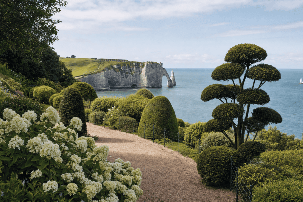 The Étretat Gardens A contemporary, poetic garden on the heights of Étretat, featuring plant sculptures, art and views of…
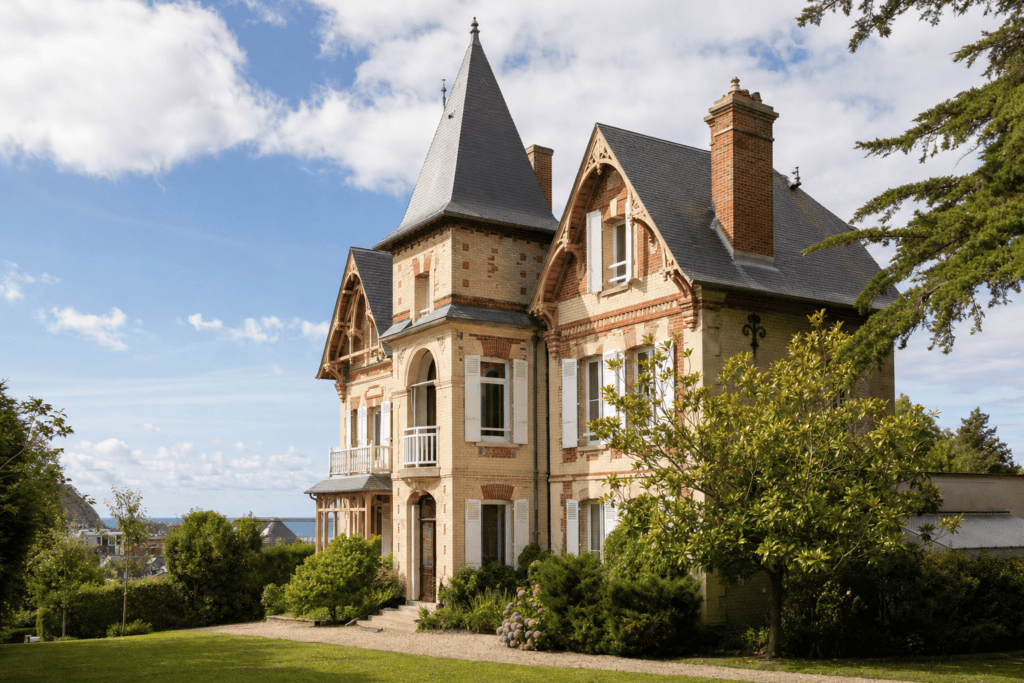 Le Clos Arsène Lupin – Maurice Leblanc House A theatrical visit in Maurice Leblanc’s former home, in the heart of Étretat, following in the footsteps of Arsène…
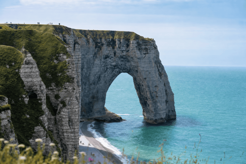 Étretat Cliffs and the Porte d’Aval Natural Arch A sweeping Normandy landscape to explore from Étretat, among chalk cliffs, a natural arch, coastal trails…
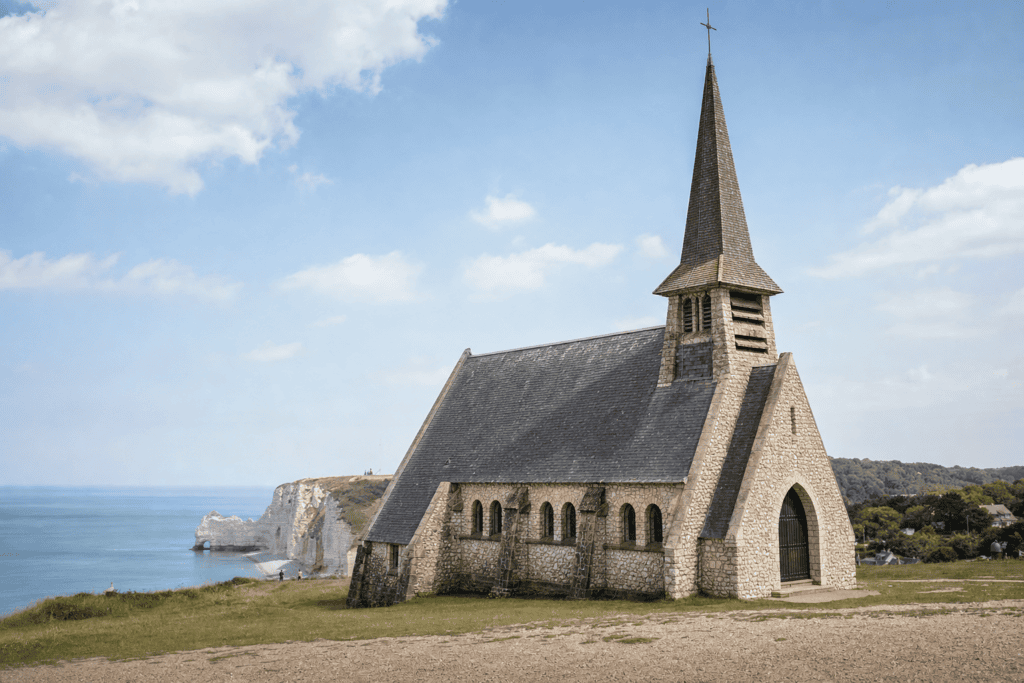 Notre-Dame-de-la-Garde Chapel in Étretat A remarkable seaside chapel on the Amont cliff, with evocative architecture and sweeping views…
Réservation en ligne · Paris → Départ conseillé : secteur des falaises d’Étretat, commune d’Étretat, Seine-Maritime, Normandie. La valleuse d’Antifer se découvre depuis les secteurs du Tilleul et de La Poterie-Cap-d’Antifer ; le parking des Trois Menhirs est mentionné par les informations touristiques locales, sous réserve des conditions d’accès et de stationnement en vigueur.
Choose your pickup date and time
Your departure and arrival details are already pre-filled. You can adjust them in the fare calculator before viewing the vehicles and fare.