



Cap Fagnet: Fécamp’s Grand Panorama
Fécamp
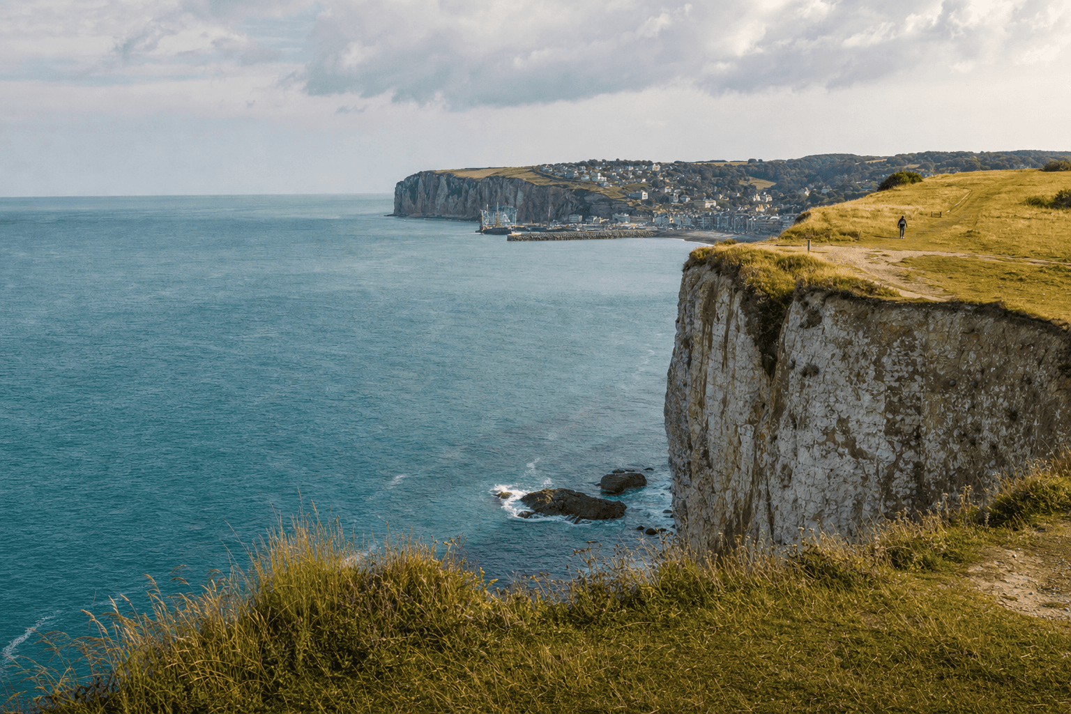
Overlooking Fécamp and the English Channel from the heights of the Alabaster Coast, Cap Fagnet is one of the city’s finest viewpoints. Visitors come to see the cliffs, beach, harbor, and valley, as well as discover a site where maritime heritage, military history, and coastal landscapes converge. The promontory reaches approximately 110 meters in elevation and, according to municipal information, is the highest point on the Alabaster Coast. A visit combines sweeping views, a walk, and a chance to discover the Notre-Dame de Salut Chapel.
Practical information
Bring a windbreaker, shoes with good grip, and a wide-angle lens. Light changes quickly along the Alabaster Coast, and winds can be strong even when the weather seems calm in the city.
Getting to Cap Fagnet from Paris
To discover Fécamp without arranging the drive yourself, Booking Paris Transfer can provide private transportation from Paris, your Paris hotel, Charles de Gaulle Airport, or Orly, with a return to Paris or continuation of an itinerary in Normandy. The service covers transportation only: any admission to sites visited and guided tours must be arranged separately.
Departure available from Paris, Île-de-France, CDG or ORY; return to Paris to be planned according to your itinerary.
A Spectacular Viewpoint over Fécamp and the English Channel
Cap Fagnet offers an especially comprehensive view of Fécamp’s landscape. From the heights, your gaze drops toward the valley, follows the seafront, reaches the pebble beach, and opens out across the English Channel. In clear weather, the white cliffs of the Alabaster Coast create a striking scene, with chalk lines contrasting against the meadows of the Pays de Caux and the changing shades of the water. The promontory’s height enhances the impression of taking in the entire city at a glance.
Start by spotting the harbor, then the beach and urban skyline, before following the curve of the cliffs. The landscape changes with the tide, mist, and light. For photography, include a nearby element, such as grass or the path, with the maritime horizon to add depth to the image. Still, take time to enjoy the panorama without rushing. Keep a safe distance from the edge: cliffs are naturally unstable and subject to erosion, even when the ground appears dry and solid.
Notre-Dame de Salut Chapel and Fécamp’s Maritime Heritage
Notre-Dame de Salut Chapel, often called the sailors’ chapel, is one of Cap Fagnet’s iconic landmarks. Located at the top of the cliff, it recalls the long-standing connection between Fécamp, deep-sea fishing, and voyages out to sea. Its elevated position also made it a landmark, meaning a visible reference point for navigators. The building has been affected by wars and severe weather, but it remains associated with the area’s maritime heritage.
Inside, ex-votos and mementos dedicated to sailors give the site an intimate atmosphere, very different from the expansive landscape outside. Visit quietly and check locally posted opening information: interior access is not necessarily guaranteed on every visit. From Fécamp, the Sente aux Matelots recalls the historic connection between the harbor, sailors’ families, and the chapel. Cap Fagnet is therefore not only a viewpoint, but also a place of protection, departure, and remembrance.
Cliffs, Coastal Flora, and Nature Watching
Cap Fagnet is part of a coastal environment exposed to wind, sea spray, dry soil, and intense exposure. Cliff-top grasslands support flora adapted to these conditions, while birds make use of rising air currents and open spaces. The heights are an interesting area for observing seabirds, chalk landscapes, and the contrasts between the Pays de Caux plateau and the sea.
To enjoy this nature without disturbing it, stay on existing paths and avoid areas marked as sensitive. Keep dogs under control when necessary and do not approach any nesting areas. Binoculars can be useful for watching birds soaring above the cliff or passing offshore. Low-growing vegetation is fragile: do not create shortcuts or pick plants. After rain, some sections become slippery; a slow, attentive walk is preferable to an improvised stroll near the edge.
A Landscape Shaped by Military History
The summit of Cap Fagnet preserves several traces of its strategic role. Local historical information refers to an ancient Gallic oppidum, a vanished fort, and blockhouses associated with the Atlantic Wall. The area also hosted a radar station during World War II. These remains may seem inconspicuous because they blend into the terrain and vegetation, but they recall the promontory’s importance for monitoring access to the valley and harbor.
The military structures add particular depth to the panorama. Visitors move from an open maritime landscape to a place that tells the story of coastal surveillance and 20th-century conflicts. However, do not enter a closed or unmarked building: some areas may be dangerous, unstable, or accessible only as part of a supervised tour. For information about historical tours, check current details from the tourist office or the relevant local organization. Even viewed from the outside, the blockhouses help explain the site.
Walks and Routes from Central Fécamp
Cap Fagnet can be explored by car, but walking offers a better understanding of the relationship between the city, harbor, and cliff. From the Quai Guy de Maupassant area, the Sente aux Matelots climbs toward the heights and recalls the former path used by sailors’ families and pilgrims. For a longer outing, the Côte de la Vierge loop starts in Fécamp. Its distance, duration, and difficulty may vary depending on the route selected and updates to the official trail information.
A short walk can be limited to the summit, chapel, and viewpoints. A more ambitious hike can combine the cape, seafront, harbor, and some paths through the Pays de Caux. Wear suitable shoes and bring water, as the wind can mask fatigue or create a misleading sense of coolness. Never descend to the beach via an unmarked route: cliffs and valleys require constant caution. Before setting out, check trail conditions after rain or severe weather.
Photography Tips for Making the Most of the Light
Cap Fagnet is an excellent setting for landscape photography because it offers multiple layers: plateau grasses in the foreground, cliffs in the middle ground, and sea and sky on the horizon. A wide-angle lens works well for panoramic views, while a telephoto lens can isolate chalk strata, boats, or harbor details. Side lighting, early in the morning or late in the afternoon, reveals the contours better than sunlight shining directly into the lens. After a shower, the air may become clearer and contrasts more pronounced.
When photographing the chapel, keep its maritime surroundings in the frame rather than treating it as a monument on its own. The blockhouses and wind turbines also provide interesting subjects for telling the story of heritage, technology, and landscape coming together. A tripod can be useful as the light fades, but set it up away from paths and exposed areas. Protect your equipment from sea spray and do not approach the drop-off for a more dramatic composition. Coastal conditions change quickly: safety should always come before getting the shot.
Planning a Responsible and Enjoyable Visit
A successful visit starts by checking local information, especially after rain, strong winds, or a landslide. Access conditions, routes, and guided-tour options may change. On site, follow directions, respect barriers, and do not enter restricted areas, even if the view seems better. Regulations and recommendations may differ depending on the viewpoint, weather, and trail conditions.
The wind is often stronger at the summit than in central Fécamp. Warm clothing, closed-toe shoes, and rain protection make the walk much more comfortable. For families, choose a simple route and keep a particularly close eye on children near the cliffs. People with reduced mobility should obtain precise information about surfaces, slopes, and proximity to parking areas, as coastal paths are not uniform. Finally, combine Cap Fagnet with the harbor, seafront, or Fécamp’s museums to create a balanced day of panoramic views, heritage, and maritime life.
Frequently Asked Questions
Where exactly is Cap Fagnet?
Can you walk to Cap Fagnet from Fécamp?
Is Notre-Dame de Salut Chapel always open?
Can you visit the blockhouses at Cap Fagnet?
What is the best time to photograph Cap Fagnet?
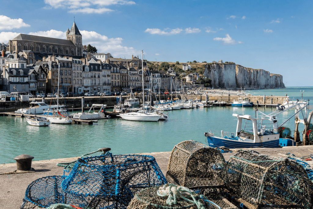 What to do in Fécamp between the harbor, beach, and Côte d’Albâtre A practical itinerary for discovering Fécamp through its port, beach, piers, maritime heritage and coastal panoramas…
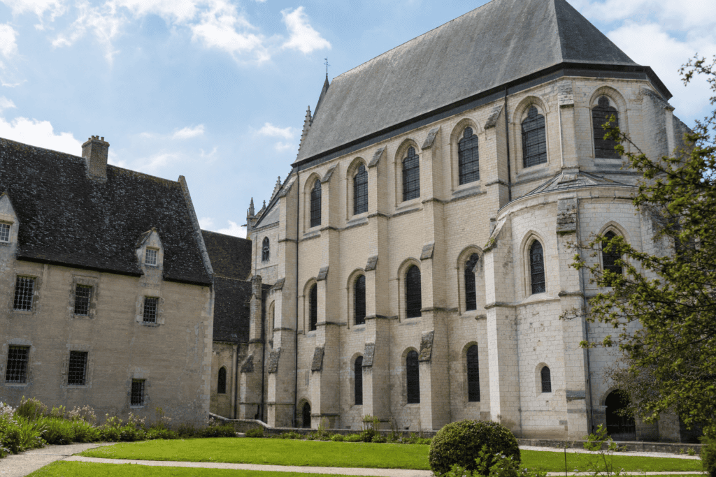 Trinity Abbey of Fécamp A magnificent Norman abbey church in the heart of Fécamp, featuring Gothic architecture, Benedictine history, and the relic of the Precious Blood…
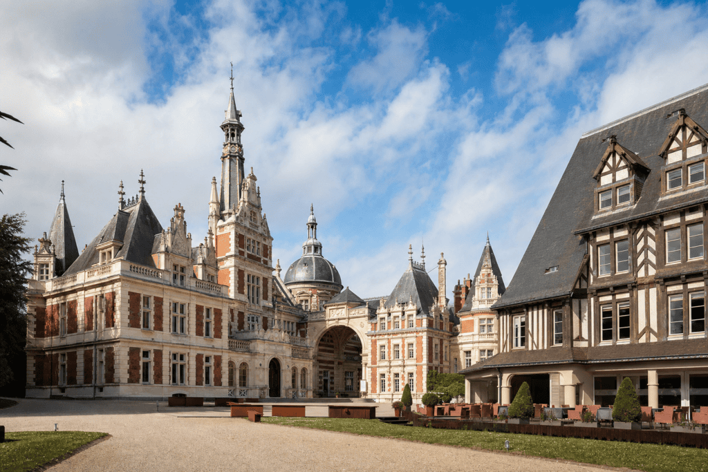 Bénédictine Palace A unique eclectic palace in Fécamp, featuring an art museum, historic distillery, antique collections and an introduction to…
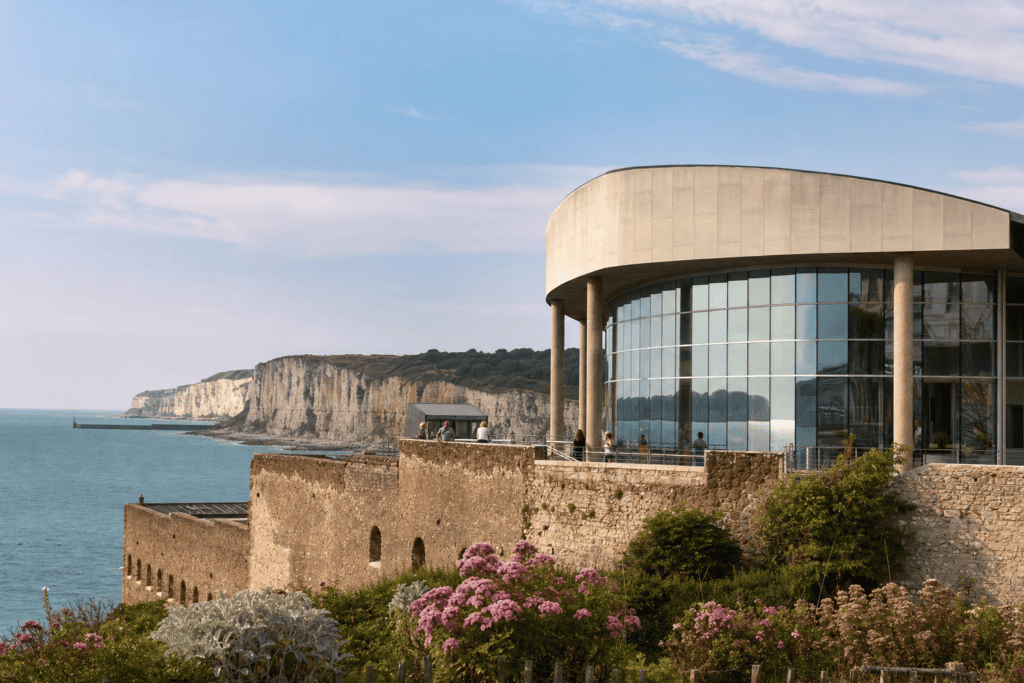 Fisheries Museum In a former cod drying house, discover the deep-sea fishing industry, art collections and the town’s memory…
Online booking · Paris → Côte de la Vierge, 76400 Fécamp, France
Choose your pickup date and time
Your departure and arrival details are already pre-filled. You can adjust them in the fare calculator before viewing the vehicles and fare.